| New 49’er Claim Number |
1/4 Section, T, R, Meridian |
 E-1 E-1 |
NEsec23 T16N R7E Hum |
| E-2 & E-3 |
S1/2sec25,SW,NW,NEsec36 T16NR7E Hum & N1/2sec31 T16nR8E Hum |
| E-4 |
SEsec13 & NEsec24 T15N R7E Hum |
| E-4 |
SEsec13 & NEsec24 T15N R7E Hum |
| E-5 |
SEsec29&NEsec32 T15N R8E Hum |
| I-1 |
SW sec32 T18N R7E hum & W1/2sec5 T17N R7E hum |
| I-1 |
SW sec32 T18N R7E hum & W1/2sec5 T17N R7E hum |
| I-1A |
E1/2sec16 T17N R7E Hum |
| I-2 |
N1/2Sec31 T18N R7E Hum |
| I-2A |
NW,SW&SE sec25 T18N R6E Hum |
| I-3 |
E1/2sec11,sec14,NEsec23 & w1/2sec24 T18N R6E hum |
| I-4 |
NE,NW&SWsec8,&SEsec7&NWsec17T17N R7E Hum |
| K-02A |
NW1/4 of Sec 11,T46N,R8W MD |
| K-03 |
S1/2 of Sec 4,T46N,R8W MD |
| K-04 |
NW1/4 of Sec18,T46N,R9W MD |
| K-05 |
NE1/4 of Sec 13,T46N,R10W MD |
| K-06 |
SW1/4sec13&SE1/4sec14,T46N,R10W MD |
| K-06 |
SW 1/4 of Sec 13,T46N,R10W MD |
| K-06A |
SE1/4 sec 16,T46N,R10W MD |
| K-07 |
NW1/4sec28,T46N,R10W MD |
| K-08 & K-09 |
NW,SW&SE1/4sec26&NE1/4sec35,T46N,R11W MD |
| K-08 & K-09 |
NW,SW&SE1/4sec26&NE1/4sec35,T46N,R11W MD |
| K-1 |
SE1/4 of Sec 8.T46N,R7W MD |
| K-10 |
SW1/4sec 22,T46N,R11W MD |
| K-11 |
S1/2sec21,T46N,R11W MD |
| K-11 |
SWsec16,SEsec17&W1/2sec21,T46N,R11W MD |
| K-12 |
NE1/4sec13,T46N,R12W MD |
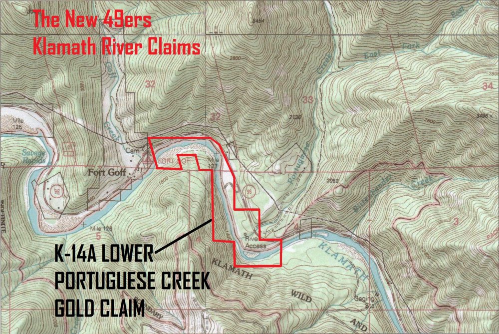
| K-13 & K-14 |
SWsec3,S1/2sec4,NEsec9&sec10,T46N,R12W MD |
| K-15 & K-16 |
S1/2sec31T46NR12W MD &SEsec10,NEsec20&NWsec21T17NR8E Hum |
| K-15A |
sec5,T46N,R12W MD |
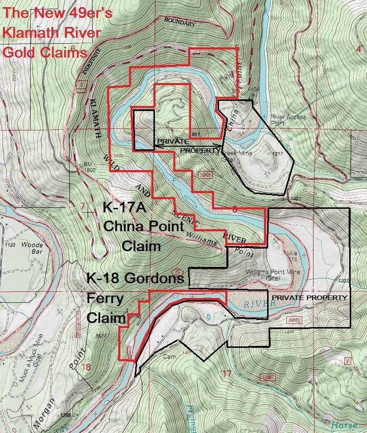
| K-17 |
W1/2sec18T46NR12W MD & sec 28 & Sec 33 T17NR8E Hum |
| K-17 |
W1/2sec18T46NR12W MD & sec 28 & Sec 33 T17NR8E Hum |
| K-17A |
NE sec 7 T16N R8E Hum |
| K-17A |
NE sec 7 T16N R8E Hum |
| K-17A |
NE sec 7 T16N R8E Hum |
| K-17A |
S1/2sec8 T16N R8E Hum |
| K-17A |
S1/2sec8 T16N R8E Hum |
| K-17A |
S1/2sec8 T16N R8E Hum |
| K-17A |
SWsec 8 T16N R8E Hum |
| K-17A |
SWsec 8 T16N R8E Hum |
| K-17A |
SWsec 8 T16N R8E Hum |
| K-17A |
SWsec5 T16N R8E Hum |
| K-17A |
SWsec5 T16N R8E Hum |
| K-17A |
SWsec5 T16N R8E Hum |
| K-17A |
SWsec5 T16N R8E Hum |
| K-17A |
SWsec5 T16N R8E Hum |
| K-17A |
SEsec6 T16N R8E Hum |
| K-17A |
SEsec6 T16N R8E Hum |
| K-18 |
NWsec17 T16N R8E Hum |
| K-18 |
NWsec17 T16N R8E Hum |
| K-18 |
NWsec17 T16N R8E Hum |
| K-18 & K-19 |
NE,SE&SWsec18 & NWsec19,T16NR8E Hum |
| K-19A |
NEsec12,T16N,R7E Hum & W1/2sec7,T16N,R8E Hum |
| K-19A |
SEsec13,T16N,R7E Hum & SW sec7 & W1/2sec18,T16N,R8E Hum |
| K-02 |
NE 1/4 of Sec 7,T46N,R7W MD |
| K-20 |
N1/2sec 1,T16N,R7E Hum |
| K-21 |
SWsec 1 &NWsec12 & SW,SE&NEsec11,T16NR7E Hum |
| K-22 |
S1/2sec10 & SWsec11 & W1/2sec15,T16NR7E HUM |
| K-22 |
W1/2sec22,NE,NW,SWsec27,NEsec33,NWsec34,T16NR7E Hum |
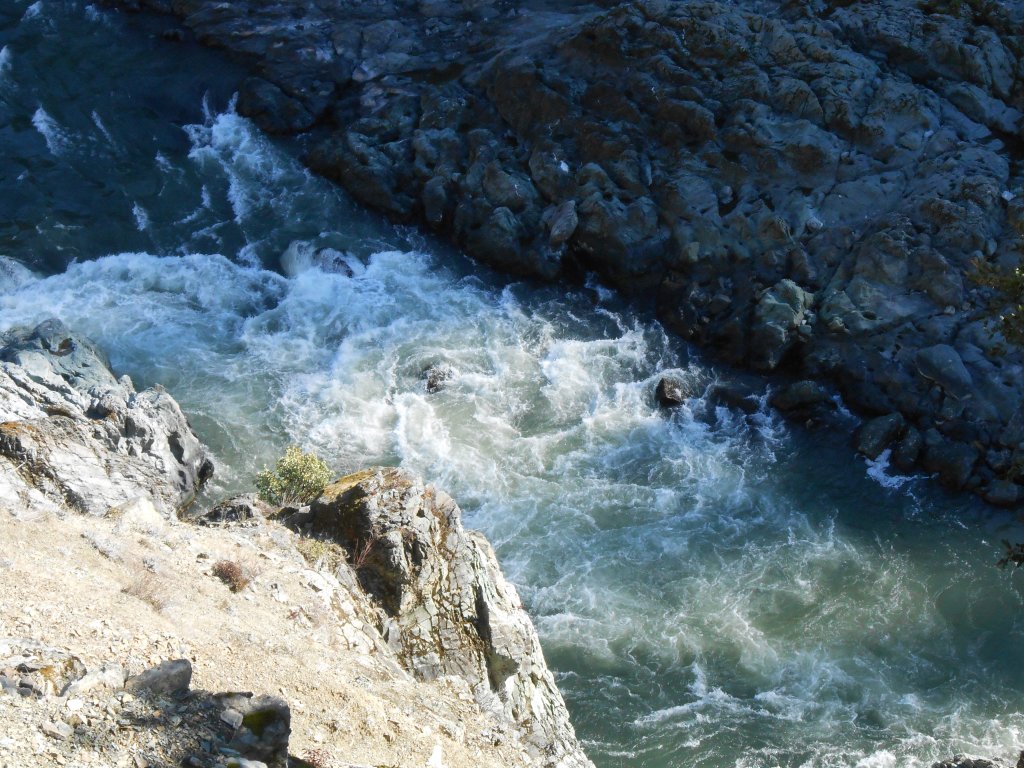
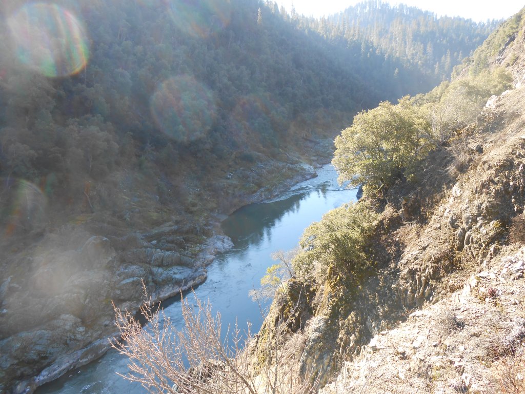
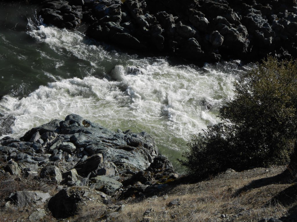
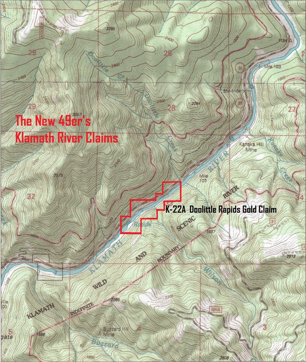
| K-22A |
NE,NW&SWsec33,T16NR7E Hum |
| K-23 |
SEsec31,SWsec32,T16NR7E Hum & NWsec5,T15NR7E Hum |
| K-23A |
SWsec5T15NR7E Hum |
| K-23A |
SEsec6T15NR7E Hum |
| K-23A |
NEsec7 & NWsec8 T15NR7EHum |
| K-23A |
NEsec7 & NWsec8 T15NR7EHum |
| K-23A |
SEsec6T15NR7E Hum |
| K-23AA |
S1/2sec32,T16NR7E Hum & N1/2sec5,T15NR7E Hum |
| K-23AA |
NW1/4sec 5,T15N R7E Hum |
| K-23AA |
NE1/4sec5, T15N,R7E Hum |
| K-23AA |
NE1/4sec5, T15N,R7E Hum |
| K-24 |
NWsec29 & E1/2sec30 T15N R7E Hum |
| K-24A |
SEsec30 & NE,NW&SWsec31T15NR7E Hum & SEsec36,T15NR6E Hum |
| K-25 |
SWsec31 T15NR7E Hum & E1/2sec6T14NR7E Hum |
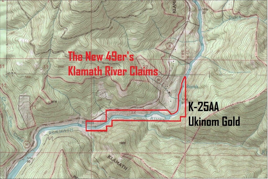
| K-25A |
SEsec11 & SWsec12 T14N R6E Hum |
| K-25A |
S1/2sec11 & NWsec14 T14NR6E Hum |
| K-25A |
S1/2sec11 & NWsec14 T14NR6E Hum |
| K-25AA |
E1/2sec12 T14NR6E Hum |
| K-25AB |
SWsec14,SEsec15 & NEsec22 T14N R6E Hum |
| K-25B |
SEsec22 T14N R6E Hum |
| K-25B |
SEsec22 T14N R6E Hum |
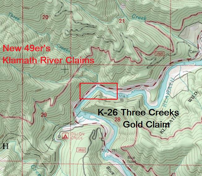
| K-26 |
NWsec28 T14N R6E Hum |
| S-1 |
SE1/4sec20 & SW1/4 sec21, T45N, R10W MD |
| S-2 |
SW1/4 sec5, T45N, R10W, MD |
| S-3 |
NW1/4 sec16, T45N, R10W, MD |
| S-4 |
NW1/4sec 8, T45N, R10W MD |
| SA-5 |
NE,SE,SW sec3, NE sec10 & NW sec11, T10N, R7E Hum |
| San-1 |
SE1/4sec 13, T10N,R7E, Hum |
| San-2 |
SW1/4,sec31,T40N,R12W MD |
| San-3A |
W1/2sec24, T40N, R12W, MD |
| San-4 |
NE1/4 sec 24,T40N,R12W MD |
| San-4 |
NE1/4 sec 24,T40N,R12W MD |
| San-4 |
NE1/4 sec 24,T40N,R12W MD |
| San-4 |
NW1/4 sec 24,T40N,R12W MD |
| San-6 |
SEsec26,T40N,R11W, MD |
| T-1 |
NW,NE,SEsec6 & NEsec7 & W1/2sec8 &N1/2sec17 T17N R8E Hum |
| UK-3 |
NE1/4 of Sec 5,T46N,R6W MD |
| UK-3 |
NE1/4 of Sec 5,T46N,R6W MD |
| UK-3A |
SE 1/4 of Sec 32, T47N,R6W MD |
| UK-4 |
NE1/4 of Sec 24,T46N,R7W MD |