

Google Earth Coordinates: 41 43’47.46″N 123 26’30.15″W
To view the content from the link above you will need to have Google Earth installed on your home computer. Download Google Earth
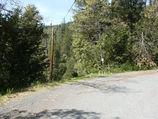
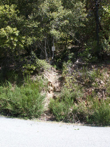
K-23 WINGATE METAL DETECTING CLAIM – is located 6.8 miles downriver from Happy Camp. There is a big pull-off parking area on the river-side of Highway 96, directly across from Forest Service Road 15N32. Hike or drive 1/5 of a mile up this road to find the trail head (very primitive) on the right side (just to the left of where the phone line stretches across the road). There is room for one or two vehicles to park directly across from the trail head. Follow the trail uphill to locate a large old hydraulic mining area on several different levels. Watch out for poison oak along the trail. The trail requires substantial physical exertion.
Here it is on Google Earth
PROSPECTS: Members have had great luck in finding gold nuggets all over the hydraulic area using modern metal detectors. Rumor has it that one member did well up there using a dry-washer, but this is unconfirmed. It is a very large area and it is reasonable to assume that it has not all been covered well with electronic detectors. Therefore, the prospects are good for finding more gold nuggets on this claim.

Upper Klamath :: Upper-mid Klamath :: Mid Klamath :: Lower Klamath
Elk Creek :: Indian Creek :: Scott River :: Thompson Creek
Salmon River Main Stem :: Salmon River North Fork
Master List of Mining Properties


