Important note concerning Mining & Dredging Seasons on this Property
Google Earth Coordinates: 41 54’37.5″N 123 26’59.6″W
To view the content from the link above you will need to have Google Earth installed on your home computer. Download Google Earth
I-2 UPPER MAIN INDIAN CREEK CLAIM – has its downstream boundary posted 2.8 miles up Indian Creek Road from the Indian Creek Bridge at South Fork. There are several access roads with camping along this claim. One is called “Coon Run” river access. This is located 3.1 miles up Indian Creek Road from the bridge at South Fork Road. The upper boundary is another 3/10 of a mile upstream-or is located 3/10 of a mile downstream from the next Indian Creek bridge.
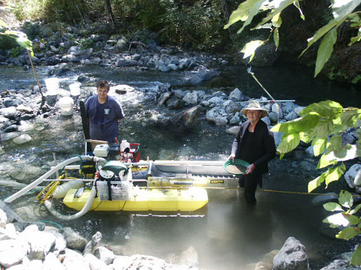
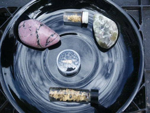
PROSPECTS: This claim is located directly beneath the famous Classic Hill and County Mine hydraulic areas. The tailings from the old mines washed down during the 1964 flood, and deposited a fairly rich layer of flood gold from 18-inches to 2-feet into the streambed material. Members have been dredging and shoveling (out of the water), and have been doing well on top of a shallow streambed layer. This section of Indian Creek has a very rich history, and the prospects are excellent.