

Important note concerning Mining & Dredging Seasons on this Property
Upriver Google Earth Coordinates: 41°47’54.21″N 123°19’4.95″W
Downriver Google Earth Coordinates: 41°47’25.12″N 123°18’49.01″W
To view the content from the link above you will need to have Google Earth installed on your home computer. Download Google Earth
K-17A CHINA POINT CLAIM – The upper boundary of this property can be located by driving upriver from Davis Road in Happy Camp on Highway 96 a distance of 5.75 miles to China Point Road. (Note: The USFS gate to this road is now locked because of a large slide which occurred during 2016) You can follow China Point Road directly to the river where there is plenty of room for parking and short term camping. Having said that, there are several difficult hairpin turns and rather steep areas along the road, so you should drive down for a look before deciding to pull a trailer or drive an RV down there. The upriver claim boundary is located near the bottom of the large gravel bar that China Creek Road leads to. The downriver boundary is located approximately 2.3 miles downriver.
With the exception of USFS Road #16NO1 which reaches the property on the other side of the river, this is an entirely remote section of the Klamath River.
To reach USFS Road #16NO1from Happy Camp, you drive .7 miles downriver from Davis Road on Highway 96 to where Elk Creek Road veers off to the left and crosses the bridge over the Klamath River. Just after crossing the bridge, you take a left on China Grade Road and follow it 8.1 miles to where you will find USFS road number 16NO1 on the left side. The Forest Service has seasonal closures on the many roads in our area, which includes 16N01. The gates to these roads are normally opened by the Forest Service (USFS) from April 1st to November 15th unless there are circumstances such as late heavy rains or snow that would prevent them from unlocking the gates.
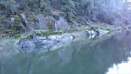
Some areas on the road are steep, so we strongly recommend 4X4 vehicles, especially when the surface is wet. Travel trailers are off limits on this road! Please be extra careful to not tear up the road! This road extends 2.3 miles down to a huge gravel bar near the top of the claim. There is plenty of room down there for parking and tent camping. You will find signs of historical large scale mining in this area. Therefore, modern day prospects are likely to be further away from the river where the gravel bar meets the sloping bedrock. Pan samples there have turned up gold out of the exposed bedrock cracks, and the advanced sampling team was excited about trying out our new form of gravity mining and some booming in the areas where the old-timers left off. Here is what John Rose had to say: “I haven’t even begun to look at any of the lower part of the new properties yet. They may only be accessible by boat. But I must say I am really excited about what I have seen and Derrick was taken aback by what he saw and said he never even imagined that the claim was there because it has been overlooked for such a long time. That and the fact that a whole new concept of mining here could possibly be done with a little ingenuity and some modification to equipment. I haven’t been this excited about a claim in a long time!”
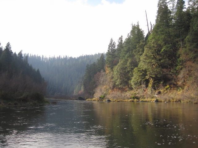
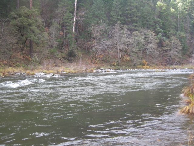
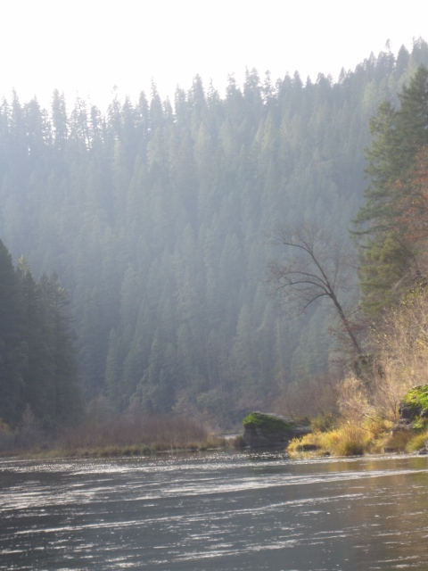
This stretch of river is mostly a remote canyon that does not include dangerous rapids. Our advanced sampling team voyaged through by rubber raft and described the area as so remote; it reminded them of something out of the movie, Jurassic Park. Our initial impression is that the stretch is going to be ideal for crevice mining and suction dredging.
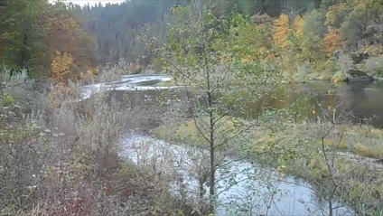
It’s still too early to tell, but our initial guess is that the best way to gain full access to this claim is by launching a raft or small boat from China Point River Access and then getting picked up later in the day (or week) at the river access on our Gordon’s Ferry Claim (K-18). The distance between the two points is just a little more than 3 beautiful miles. With the exception of a 1-mile stretch of private property (see maps), we have mineral access to the entire stretch. The floating distance is short enough that you could make day trips in and out of your mining site. Or, this would be a fantastic area to do some remote camping along the river.
There are just a very few long, remote stretches of the gold-bearing Klamath river that are not blocked by dangerous white water. In fact, this may be the only one. So we are very lucky to have it!
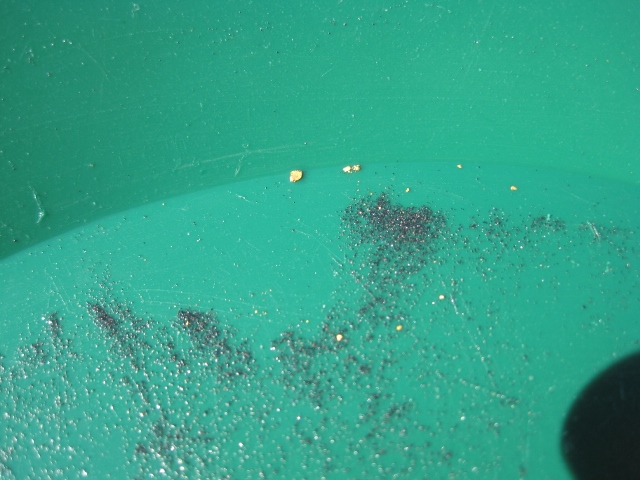
PROSPECTS: This portion of the river has a very rich mining history. Though, because of remote access, we suggest almost no prospecting has taken place in this area during the modern age. Shortly before the dredge moratorium took effect in California, several of our members devoted about a month of dredging directly at the top end of this property. They were bringing their gold into the office for us to see; and the golden treasure they recovered, consisting of mostly large flakes and nuggets, took our breaths away! This is a very proven, rich section of the Klamath River, with gold mining history going back to the very early days. Members have done exceptionally well both in and alongside the river on our Gordon’s Ferry Claim just downriver.


Upper Klamath :: Upper-mid Klamath :: Mid Klamath :: Lower Klamath
Elk Creek :: Indian Creek :: Scott River :: Thompson Creek
Salmon River Main Stem :: Salmon River North Fork
Master List of Mining Properties


